Capture geometry and asset condition
Stereo imagery and 3D reconstruction document underwater asset surfaces and geometry. In-field coverage review supports acquisition planning and helps identify areas that need additional capture.
 SUBSEA SERVICES
ROV NZ / SUBSEA SERVICES
Turn underwater stereo imagery into reconstructed asset geometry, textured models and recorded dimensions for engineering review.
Discuss your projectStereo imagery and 3D reconstruction document underwater asset surfaces and geometry. In-field coverage review supports acquisition planning and helps identify areas that need additional capture.
Applications include chain dimensioning, line orientation, flange and spool geometry, and structural measurements. Annotated dimensions can be placed directly on processed models to support review. Survey control, measurement uncertainty and acceptance criteria are defined for each scope.
Outputs can include point clouds, textured OBJ models, annotated measurements and agreed engineering documentation. Relative accuracy, absolute accuracy and repeatability describe different aspects of a result; requirements are agreed before field work.
PROJECT EVIDENCE / DECOMMISSIONING & MOORING CHAINS
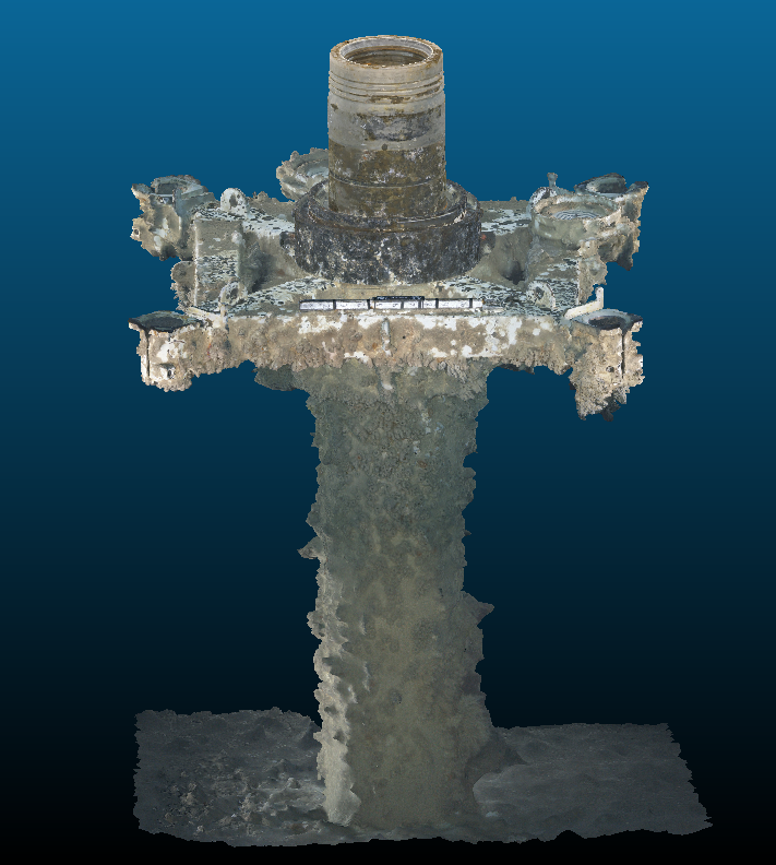
ROV NZ surveyed 17 subsea wells as part of a major Australian oil and gas decommissioning project, using stereo imagery and 3D reconstruction to support engineering review.
Our mooring-chain examples show dimensions placed directly on image-reference views and processed models. Achieved measurement repeatability in the featured chain campaign was approximately ±0.5 mm; this is distinct from absolute accuracy.
View annotated chain measurementsLET’S TALK ABOUT YOUR PROJECT
Share the asset, location, scope and intended deliverables. We’ll help identify a practical approach.
info@rovnz.co.nz