Map seabed and reservoir terrain
Our USV surveys cover marinas, berths, hydro reservoirs and shallow-water infrastructure. Coverage planning and overlapping sonar capture provide the basis for point-cloud review, filtering and surface generation.
 SUBSEA SERVICES
ROV NZ / SUBSEA SERVICES
Map underwater terrain with compact surface-vessel surveys, 3D sonar and positioning. Create spatial datasets for planning, modelling and engineering review.
Discuss your projectOur USV surveys cover marinas, berths, hydro reservoirs and shallow-water infrastructure. Coverage planning and overlapping sonar capture provide the basis for point-cloud review, filtering and surface generation.
Coordinate systems, vertical datums, positioning, coverage and acceptance criteria are defined around the project. RTK positioning supports georeferenced acquisition; achievable accuracy and uncertainty depend on the survey method and control.
Deliverables can include raw and filtered LAS point clouds, E57 point clouds, GeoTIFF terrain models, DXF contours and OBJ surface meshes. We agree the formats and level of processing with the people who will use the data.
PROJECT EVIDENCE / OKARA MARINA
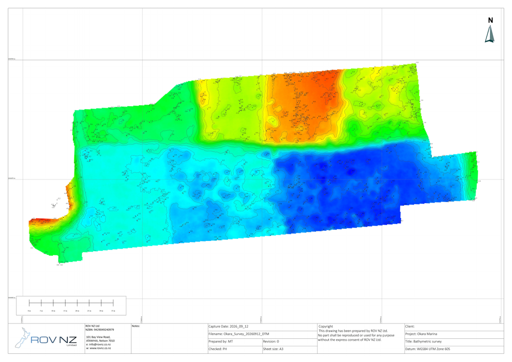
The marina survey captured 14.7 million raw sonar observations using overlapping 3D sonar scans and dual-antenna RTK GNSS. Delivered outputs included point clouds, a bathymetric terrain model, 20 cm contours and a surface mesh.
These results describe this survey. Coverage, accuracy and deliverables are defined for each project.
View survey method and deliverablesLET’S TALK ABOUT YOUR PROJECT
Share the asset, location, scope and intended deliverables. We’ll help identify a practical approach.
info@rovnz.co.nz